Statewide :: News & Press :: Interactive Map :: Map Poster :: About the Map :: Landsat Lake Images
Press Release: 13 January 2003
Contact: Thomas Lillesand, (608) 263-3251, tmlilles@facstaff.wisc.edu
RESEARCHERS TRACK LAKE WATER CLARITY FROM
SPACE
- GRAPHICS -
These images accompany the press release "RESEARCHERS TRACK LAKE WATER CLARITY FROM SPACE." The text of the release can be found at http://www.lakesat.org/lakes_from_space_text.php.

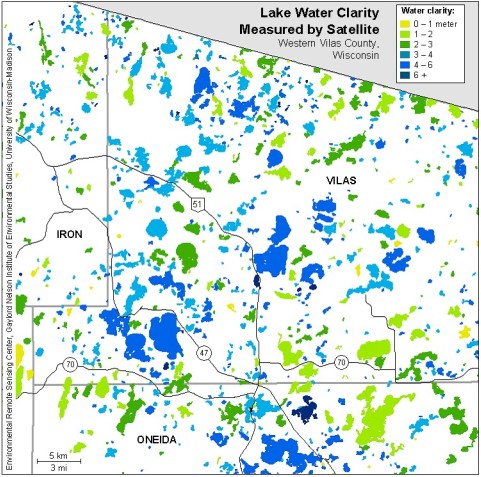
Caption: Map of lake water clarity
for western Vilas County, in northern Wisconsin. The Landsat-5 and -7
satellites were used to measure the clarity of more than 8,000 lakes
statewide on eight dates during the late-summer seasons of 1999-2001.
The satellite images were analyzed in combination with field observations
made by a network of citizen volunteers.

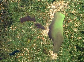
Caption: Satellite image of Lake Winnebago,
Wisconsin, acquired on September 2, 2001. This image is from the MODIS
instrument on NASA’s "Terra" satellite. Terra, and its sibling satellite
"Aqua," collect data twice daily over Wisconsin, at a coarse spatial
resolution suitable for monitoring the largest lakes in the state. The
green color of Lake Winnebago is due to an algae bloom that was occurring
at the time this image was acquired. |


